Sunday, July 30, 2017

BLIND BAY AND EAGLE HARBOR

We have actually planned out the next few days. We don’t usually do much planning, other than say “Well, where do you want to go tomorrow?” But, we have specific things we need to get done soon - like get the boat hauled out of the water and have the bottom painted, and retrieve our car from the garage where it is stored in Tacoma.

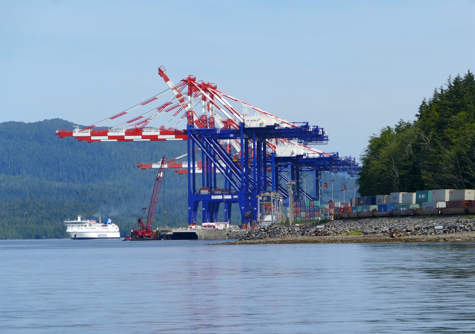
So, we have made arrangements for the boat to be hauled in Bellingham on Tuesday, August 1st. We will rent a car there, then drive down to Tacoma, return the rental car and pick up our car. We will then drive home to the Bay Area to attack our pile of mail, pull up the plants that have died, make a few appointments, then, in a week or two, fly back up to Bellingham to continue our voyage. The general idea is to bring the boat back down to San Francisco Bay, hopping down the Pacific Coast during periods of good weather and hanging out in harbors of refuge when conditions aren’t just right.

Since we have had a few days to kill before getting to Bellingham, we are just slowly wandering through the San Juan Islands, gradually heading east. Yesterday we anchored in Blind Bay on the eastern side of Shaw Island, dinghied in to shore and took a nice long walk of several miles along the roads. There was minimal traffic, and what little there was came by only just before, or just after the ferry landed on the island.

This morning was a lazy morning. We slept in a bit, then, trying to use up our food stores, cooked breakfast (Spam & eggs burritos) rather than just have the usual cup of coffee. Late morning, we weighed anchor and cruised over to Eagle Harbor on Cypress Island. This is a beautiful little cove where we stayed a night last year when we chartered a boat out of Bellingham. A large portion of Cypress island is owned by the Department of Natural Resources and maintained as a nature
preserve. To prevent damage to the underwater vegetation they have installed mooring buoys so you don’t have to anchor in the cove. We picked up a mooring, then took the dinghy into the beach to go for a hike. Last year we hiked up to the top of Eagle Crest, so we decided to go the other way this time and hike over to a couple of lakes. The trail signage is pretty good, but not perfect, so we put in a little extra milage. We hiked a total of about three and a half hours, over trails that had, obviously, seen little use. It was a nice, warm, sunny day, and we only saw only one other group of hikers. We don’t know exactly how much we climbed, but it was significant - the island tops out at over 1500 feet, and we were very near the top at times.

We will leave here in the morning and head over to Bellingham, spending tomorrow night in the marina in anticipation of having the boat hauled on Tuesday morning. I’ll be taking a short break from the blog while we run home for a week or two, but will resume when we’re back on the boat.

Thanks for reading - hope you have enjoyed it…

Friday, July 28, 2017

BACK TO THE USA - SHAW ISLAND


It was a short two hour trip from Todd Inlet and Butchart Gardens over to Port Sidney Harbor, however, we had to hang out in front of the marina at Sydney for a while to wait for a slip to open up. This meant that we didn’t actually get tied up until just after noon. This is a big marina, where we have stayed before, and the transient docks (for short-term visitors) are about a five minute walk down a looong dock to the Dockmaster’s Office and land.

Once we were registered, Elaine took off to walk through town, while I spent a couple of hours washing down the boat. This was the first real exterior cleaning I had done since we started in May. With the wind and waves, the boat gets covered in salt, but all the rain we have run into has washed it off. Without seeing any rain for a while, I had to wash it off myself.

We timed it right for the weekly Evening Street Market in downtown Sidney. They close off the main street for three blocks and have both food and craft vendors lining both sides. It is quite a draw, with crowds enough to make walking difficult at times. We opted for an English-style sausage roll for dinner, which we ate at the park down at the waterfront. After an ice cream cone for desert, we walked back to the boat and discovered we could get over 10 channels on our TV. This, after only one channel a couple of nights in Ketchikan for the past couple of months. It was too much for me - I went to bed, but Elaine stayed up late getting her TV fix…

This morning (Friday) we left Port Sidney Harbor and had a nice, short cruise over to Roche Harbor in the San Juan Islands - back in the USA! This means, of course, back through Customs once again. We totally gave up on our Small Vessel Reporting System (SVRS) participation with Homeland Security. I called them yesterday, asked how to go about doing things the right way, since it hasn’t worked the last four times we have tried. They basically said to forget it, it was a program put together by a multi-departmental Task Force and, even though it was a good idea, no one department ever took ownership of it, so it is now almost completely dysfunctional. I could have told them that…

We decided to do the conventional Customs thing, just like everybody else. We pulled in to the Customs Dock, I went up to the office, waited about three minutes, did the interview and the agent came out to the boat for a quick eye-over. It was all done in less time than it takes to get through the SVRS phone menu.

We left Roche Harbor and headed down to Friday Harbor, thinking we would anchor out there for the night and stop by the grocery store in town while there. We tried to find a place to anchor which wasn’t so full of boat traffic and ferry wakes, but never did. We did anchor for a short while to make a run into the store, but then left the utter chaos of a summer Friday at Friday Harbor for a quiet little bay across the channel on Shaw Island…

Wednesday, July 26, 2017

TODD INLET - BUTCHART GARDENS

Sunrise, Nanaimo

Another early morning to catch the tide. We left Nanaimo at 5:30 so we could get to Dodd Narrows around the slack ebb at 6:39. It was kind of like a parade leaving the anchorage - several boats had the same idea and left around the same time. We got to Dodd Narrows close to 20 minutes early and some boats just hung out, waiting for slack, while others just charged on through. We charged on through and it was pretty underwhelming. We’ve had a lot more current in a lot more places on this trip.

On our trip up, heading north from the Gulf Islands, Dodd Narrows was the first passage where we had to time the tides, and we were quite proud of ourselves for having made it without mishap. Now it’s pretty much old hat. Later in the day, today, we had to go through Sansum Narrows, and we arrived just at the maximum current flow. Oh well, no sense waiting for slack tide. We went on through and, again, no big deal. Sure, there were some whirlpools, some upwellings and an overfall, but they’re all part of the game, now, and we’ve gotten used to handling them.

Since we left Nanaimo so early, we made it to Todd Inlet around noon. This inlet is the “back door” to Butchart Gardens and has a few moorings which can be used by Garden visitors for free. They are in a narrow cove, and you have to tie the stern of your boat to rings set into the rocks for that purpose to keep the boat from swinging into the channel. We have moored here before, but probably at least 25 years ago. I remember, vividly, that it was a place very few people knew about - isolated, quiet, out of the way - but that’s not what it is like now. Once we got to the inlet, I recognized it, but the bay outside of the cove is crowded with moored and anchored boats, there are two marinas there and the shores are covered with condominiums.

Before we got to the inlet, I had thought about the logistics of picking up the mooring ball and setting a stern line to shore. Let’s just say it didn’t quite work out as planned. We did get secured to the mooring ball and we did get a stern line to shore, but in the midst of all of this, the dinghy managed to wander away from the boat. As much as I yelled, and pleaded, for it to come back, it wouldn’t, so there was only one way to recover it. The water wasn’t actually quite as cold as I had anticipated, but it was cold...

The last time we were here, I remember going into the garden through this back door without paying. That is no longer possible, and the prices are pretty incredible - almost $80 for the two of us. It is a beautiful garden, but it has become a “Disneyland” - like tourist attraction with crowds of people, souvenir shops, galleries, ice cream stands, hot dog stands, coffee bars, restaurants and even live stage entertainment and fireworks shows at night. Not quite what I remember. The little cove we are in has routine bay tour boats going in and out, as well as large tour boats bringing passengers from Victoria, and they warn to keep the waterway and dock clear for floatplanes.

I feel like an old curmudgeon, “It didn’t used to be this way…”

Tuesday, July 25, 2017

CAMPBELL RIVER SOUTH TO COMOX THEN NANAIMO

July 24, 25

Fisherman’s Wharf was a very interesting marina in Campbell River. Half of it was mostly pleasure boats and, separated by a pier, the other half was mostly working fishing boats. We were on the fishing boat side and had the opportunity to interact with some very colorful folk. They love to tell stories, one or two of which may have actually been true. They were all entertaining, though.

Since the tidal current is so strong at Campbell River, we waited to leave until the tide turned and we had the current going with us. This meant we didn’t leave the marina until almost noon, then got into Comox after 4 PM. We didn’t really end up getting much help from the current. Along the east side of Vancouver Island, the flood tide comes in from both the north and the south then meets a few miles south of Campbell River. So, the ebb tide north of this point flows north and the ebb tide south of this point flows south. In that middle area, the currents are all mixed up, making for a lumpy, choppy sea.

Other than the sea state, it was a very nice day, the warmest day we have seen up here all summer. By the time we got tied up to the dock, it was over 80 degrees! Luckily, there was a pub right next to the marina (funny how they seem to know that boaters gravitate toward pubs). We sat outside, under the umbrellas, but this time protected from sun, not rain.

Comox is a nice little community with a very nice, inexpensive municipal marina. The community seems to be very water-oriented with the nice weather drawing out the small sailboats, paddleboards, kayaks, fishermen and pleasure boaters into the harbor. There are a couple of other small communities nearby which we did not have time to visit, but the whole area seems quite pleasant.

Again, timing the tides, we left Comox before 7 AM so we could catch the ebb heading south. The first few hours were very smooth and it warmed up nicely with the sun shining. Later, especially when we got out of the lee of a couple of islands, the water started developing some swells, which eventually turned into waves, even though the wind was light. The waves were from the west, and we were heading southeast, so it wasn’t too bad - a lot of movement, but tolerable. While making lunch, I did have to quickly grab the mustard jar as it slid across the countertop, but disaster averted.

Once we ducked into Nanaimo Harbor, however, it was a totally different environment. People were swimming, playing in and on the smooth water - I even saw an outrigger canoe club out paddling. We anchored in a crowded anchorage (it is the “high” season around here for boating), got out the “lounge chairs,” and had some refreshment on the bridge deck in the hot, hot sun. We couldn’t stay up there long before we had to retreat to the shady cabin down below.

Elaine wanted to go to the nearby island to check out the sandstone quarry (where the stones for the San Francisco Mint came from) and the albino raccoons they have there. We tried to find a  place to land the dinghy, but couldn't - ending up at a place inaccessible to the quarry. However, what do you know, there was a floating pub with a dinghy dock...

Sunday, July 23, 2017

CAMPBELL RIVER, DAY 2


We decided a layover day was in order, first because it was a somewhat stressful day going through Seymour Narrows yesterday, second because we had a lot of laundry to do, third because it was very windy, fourth because we needed to do some boat cleaning, fifth because there was a Farmer’s Market scheduled and sixth because there were a couple of museums we wanted to visit.
Farmer's Market

Laundry was first - got that done - then the Farmer’s Market, which opened at 10 AM. It was a very nice Market, right at the top of the dock. We bought a few things, brought them back to the boat, then headed up to the Campbell River Museum. That is an excellent little museum, with a varied number and type of exhibits, everything from First Nation history, to local development history, to natural history. We spent a few hours there, including watching a film of the efforts to blow up a large rock in the middle of Seymour Narrows in the 1950s. The rock was such a hazard to navigation, a massive effort was undertaken to get rid of it. The resulting explosion was the largest non-nuclear detonation in history, and it got rid of the rock.
Campbell River Museum

We then stopped by the Maritime Heritage Museum which, as the name suggests, is focused on the fishing and shipping history of the area. It was not a large museum, but Harold made up for it. Harold is a retired boatman and crabber who constructs incredibly detailed ship models in his spare time and also volunteers as a docent at the Museum. Oh, and Harold loves to talk. Since we were the only two people in the museum, we were the objects of his attention. He actually made the museum much more interesting, although we were relieved when another patron came in and we ran a successful pick and screen.
Maritime Heritage Museum


One of my objectives for the day was to wash down the boat, but that was thwarted when the fellow from the next boat over started up a conversation. Maybe it’s the long, wet winters around here, or something, but people really like to talk once the sun is shining. We had a very long, wide-ranging conversation (which Elaine managed to duck out of) and the boat is still dirty.

Since he is local, part of the conversation focused on tides and current in the area. Elaine & I watched a few boats trying to swim upstream today, and they made very slow progress. We will be heading south tomorrow, so will need to time our exit from the marina to coincide with the slack ebb tide, or the beginning of flood tide. I actually got a lot of good local knowledge from the guy, so the conversation was probably more valuable than having a clean boat anyway…

Saturday, July 22, 2017

CAMPBELL RIVER


First things first - pictures I couldn’t upload yesterday:

Elaine with her Bear Bell


Hiking in the Rain


The Cedar Tree

Had a nice dinner at the Blind Channel Resort restaurant last evening and a quiet night at their dock. We studied the charts, the tide tables and the current tables to plan out our day today. All of the atypical planning, for us, was because we had to transit Seymour Narrows today. This is a relatively narrow channel between Vancouver Island and Quadra Island. A huge amount of water flows north from the Strait of Georgia through these narrows to Discovery Passage. The currents can run as high as 15 knots, with severe upwellings and whirlpools - severe enough to have sunk ships in the past. You must time your transit to coincide with the slack tide, that is, between the flood tide and the ebb tide - either at the end of the flood or at the end of the ebb. The good news is that we did not have the usual high winds typical of Johnstone Strait, the bad news is that it is a new moon, so the tidal changes are about at their peak flows.

We left Blind Channel around 7 AM and had the current with us the first 4 miles, then we turned on to Johnstone Strait and were bucking a 3-4 knot current. There was a lot of water movement, and it was a challenge keeping the boat headed in the right direction. On top of that, the visibility was very poor, with thick fog intermittently obstructing visibility down to less than a quarter mile. Oh, and it was cold and raining, too. So we had the usual routine of heater, defroster, and windshield wipers, but we added the fog horn to this routine as well. Once we rounded Chatham Point, things calmed down a bit, although we still had a current on the nose.

We timed our arrival at Seymour Narrows to coincide with the slack, but it also coincided with the thickest fog of the day. We had been monitoring the vessel traffic control (kinda like air traffic control, but for commercial ship traffic) on the VHF radio, and knew that a passenger liner and a coast guard cutter were coming through the narrows the opposite way, but we couldn’t see a thing. As they came through, we identified them on radar, but didn’t see them until they had almost passed us.

Even though we went through at slack tide, the water was anything but slack. I increased the engine speed, but at times we were going only 5 knots and then, very quickly, we were going 10 knots. Lots of eddies and whirlpools for a slack tide!

Anyway, we made it through, and the fog lifted. We continued south to Campbell River where we docked at the Fisherman’s Wharf Marina with all of the commercial fishing boats. We took a quick walk into town and perused the art fair along the (closed) main street and ran a couple of errands. There are a couple of museums here in town we’d like to see, and a Farmer’s Market nearby tomorrow morning (and the sun is supposed to shine), so we will decide tonight whether or not to stay here another day...

Friday, July 21, 2017

JONSTONE STRAIT

July 20 & 21 (Can't upload photos - will try later)

I’ll combine a couple of day’s blogs, since not a lot happened yesterday. Yesterday started at Port McNeill just taking care of boat business - filling some tanks, emptying others - and we finally got away around 10 AM. The weather was good, overcast but no rain. We were heading down Johnstone Strait, which has a really bad reputation when the wind and tidal currents are against each other. Luckily, we had a favorable current and little wind most of the day. A pleasant ride, with just a little chop now and then, but, for the most part, smooth.

Our destination was Port Harvey, where we have stayed before at the marina. The marina is being rebuilt, and doesn’t have a lot in the way of amenities, so we just anchored out in the bay this time. I put out some crab pots, since this was where we got the first crab of the trip, but no luck this time. We did have a bunch of crabmeat in the freezer, however, and Elaine made Crab Pasta Pizzicato. This was a dish we both had in Prince Rupert, so she just had to try it. Her explanation: “It’s crab and pasta with an Alfredo sauce, but instead of milk products you use lemon juice and vermouth then add capers.” Somehow I think that ends up being a lot different than an Alfredo sauce, but it was incredibly good, anyway.

This morning we headed further southeast on Johnstone Strait in a steady rain. The tidal currents were both for and against us during the day, but the fastest currents, through Race Passage, were strongly in our favor at about 4-5 knots. That passage was also the area of least visibility, with fog dropping visibility down to less than a quarter mile at times. Definitely radar time. It felt kind of like flying an airplane on instruments only, looking at the GPS to determine location, checking the speed and depth every minute or so and always keeping an eye on the radar to make sure you weren’t headed toward anything (or anything was headed toward you), going 11 or 12 knots. Current that fast causes a lot of swirls, whirlpools and overfalls, all of which affect the handling of the boat, so no autopilot, since you had to react quickly to all of the movement of the water. A nice feature of our instruments is that they can overlay the radar image on top of the electronic chart image, making it easier to identify “targets” that are not land masses.

We got into Blind Channel Resort by early afternoon. We had hoped to stop by here on our way north, but it just didn’t work out. Even though it was pouring down rain, we took advantage of some trails nearby to hike to a 900-year-old cedar tree out in the rain forest. The sign at the beginning of the trail warned of bear, cougar and wolves, but Elaine had her trusty “bear bell” (better known in the Grizzly clans as a “dinner bell”) tied to her shoelace, so we were safe - wet, but safe!

Back at the boat we cleaned up (the trail was kinda muddy) and will be going to dinner at the resort’s restaurant…

Thursday, July 20, 2017

SOUTH AROUND CAPE CAUTION

When I put the coffee on the stove at 4:30 this morning, I noticed the lights on in a few of the boats at anchor in Fury Cove. The wind was still and the forecast had not changed, so we were expecting a "reasonable" rounding of the Cape. Being further south, and a bit later in the summer, the sun didn't rise until around 5 AM, but that was when we pulled anchor and headed out.

The first couple of hours were pretty calm as we approached the open ocean, although the swell did build up to 2-3 feet. Unfortunately, the swell was from the west, which meant a beam sea - swells hitting us on the side - a bit uncomfortable with all the rolling. To minimize this effect, we headed further out to sea, into the swells at an angle. Once we were far enough south, we angled back in toward the Queen Charlotte Strait and had the swells, pretty much, at our stern, which was more comfortable.

When we passed Cape Caution heading north several weeks ago, we saw only one other boat on the water. Today, we left Fury Cove with five other boats heading south, and saw another half-dozen or so while we were out there. The wind was light all day, from 5-10 knots, and varied from southeast to northwest. The skies were cloudy most of the morning, but cleared a bit, and showed some blue sky, in the afternoon. A better crossing than our first time.

The further we got in to Queen Charlotte Strait, the calmer the water became. As we were passing the Walker Islands, we saw several whale spouts and a couple of pods of porpoises - must have been a good feeding area. We slowed down for a while so I could try trolling for a salmon, but gave up after a half hour without any bites. I really don't have the right fishing gear for salmon, so that may be the end of my try at salmon fishing.

We were fully around the Cape, and into Queen Charlotte Strait by about 10 AM, so with the conditions favorable we decided to keep going to Port McNeill, another 40 miles or so. The winds remained light, the sun came out and we had a favorable tide, and even though it was a long day, it was a nice voyage down the Strait. While we were underway, Elaine took a shower, washed her hair, then sat out on the foredeck using the sun and breeze as a hair dryer.

Once docked at Port McNeill, after a 9+ hour day, we re-provisioned at the grocery store, then grabbed a quick bite at a local pub before an early bedtime...


Wednesday, July 19, 2017

PRUTH BAY, DAY 2

How nice to wake up and see sunshine streaming through the porthole. Even though it was cool, the sun warmed up the cabin so we didn’t have to turn the heater on for a change.

We got the dinghy down and motored over to the Research Institute’s dock. They are a not-for-profit educational institution doing research on the long-term environmental impact of humans living in the BC North Coast area. They provide facilities, labs and grants to BC university students, and others, for them to continue their environmental studies. I was very impressed with the facilities - modern and very well maintained.

West Beach
We took the trail over to West Beach on the western side of Colvert Island, wandered around that fantastic cove for a while, then found the trail over to North Beach. The trails are incredibly well maintained, although the one to North Beach is a bit more of a challenge. North Beach, also, was a gorgeous beach and setting.

West Beach
We backtracked to West Beach, then back to the dock where we met a father and daughter from another boat catching crab off of the dock. The water was so clear, you could look down 20 feet or so and see the crabs walking around, going for the bait in the trap. I’m sure they got enough for dinner tonight.
North B

We left the anchorage a little after noon to go over to Fury Cove, getting ready to round Cape Caution. You could tell this was the first break in the weather for a while - there are 14 boats anchored here tonight waiting for tomorrow’s dawn to head south. We got the dinghy down again & explored the cove a bit. There are some brilliant white beaches surrounding the cove, but when you get on to them they consist of crushed shells, not sand. Back at the boat, we sat in the sun on the bridge deck in our lounge chairs. Only the second time this whole trip conditions were agreeable enough to do that.

We’ll have a simple dinner tonight and get to bed early, anticipating an early rise. The distance we have to go tomorrow isn’t that great, about 45 miles or so, depending on which anchorage we go to, but the conditions can make it seem a lot longer…

Monday, July 17, 2017

PRUTH BAY

July 17

Our isolated, private bay we anchored in last night had another boat in it when we woke up this morning. I’m surprised they found their way in at night, but I am glad they were quiet. Actually, we could barely see them this morning because the fog was so thick. Visibility was less than a quarter mile, in fact, we could not even see across the bay and down the entry passage. There was nothing to do but wait. Even with the GPS and radar, I’d rather not be out there under those conditions if I didn’t have to be.

We had a leisurely second cup of coffee and puttered around doing a few maintenance chores before the fog started lifting, and we were underway by around 8 AM.

Our route took us back through Shearwater and Bella Bella, but we didn’t stop this time. We kept on going through Lama Passage and down Fisher, then Fitz Hugh Channels. The weather was wonderful - bright blue sky, sunshine and, for here, warm in the low 60s. We also got an unplanned boost from the ebbing current all day (although we never figured out how the tide could ebb all day without reversing). The tide and current tables for this area are not always totally precise, but it was nice to get an extra knot or two for the day.

With the extra speed, we decided to make Pruth bay for the night. There is a research institute here (we don’t know what they research, we’ll find out tomorrow) that allows you to dock your dinghy and take a nice hike over to the beaches on the West Coast of Hecate Island. They also provide free internet to anyone anchored out in the bay (a major draw in these parts). The internet is really nice, since we will be able to access the weather forecast for the next few days and plan our return around Cape Caution. This, as you may recall, requires voyaging out into the Pacific Ocean, which tends to be pretty rough around here. We had a short taste of that today when we opted to get to Pruth Bay by way of Hakai Passage - another unprotected area on the West Coast of Canada. It was such a beautiful day, and had been so calm and smooth, we felt adventurous, and took Hakai. It wasn’t all that bad, about a 1-2 foot wave on the nose, and some beam seas when we turned into the channel leading to the bay, but the wind was very strong at 15-20 knots. We hadn’t really battened everything down for a rough passage, so Elaine had to chase a few things around the cabin to secure them.

The plan is to see the Research Center and do some hiking tomorrow, then stage ourselves tomorrow afternoon for an assault on Cape Caution. We’ll probably anchor down in Fury Cove, and if the weather forecast is accurate, head out around Cape Caution very early (like around 5 AM) on Wednesday. Conditions look good, not perfect, but good for the morning with very light winds until early afternoon. The only drawback is that the wave forecast is for 1-2 feet at 6 second intervals coming from the west. This means a beam sea with lots of rocking side to side. If necessary, we can “tack” into the seas and hit them at a 45 degree angle for a distance, then reverse course 90 degrees and go with the waves. It’s not nearly as efficient, but may be worth the trouble for comfort’s sake…

BOAT INLET

July 16

We left Butedale with a porpoise - actually a whole pod of them. The Dall’s porpoises escorted us, playing in the bow wave of the boat, jumping and generally cavorting around us for probably 15 or 20 minutes. I had the door to the pilothouse open (even in the rain) and there they were, screaming by and jumping just a few feet away. As a swimmer, it was amazing to watch them move so quickly and effortlessly through the water - it made me insanely jealous!

After our escort, we continued south and took the Tolmie Channel down until we crossed over to the Finlayson Channel around the First Nation town of Klemtu. We then had a decision on whether to go “outside,” through Milbank Sound (the way we came up) or cut through Jackson Pass and Reid Passage. Since the wind was out of the southwest, this would have meant an uncomfortable beam sea (waves coming from the side) in the Sound, so we elected to go the more protected route. The last hour or so was against a pretty strong flood tide, bucking about a 2 knot current, making only 5-6 knots headway.

It was a long day, covering 70 nautical miles, so we were looking for an anchorage nearby. The one indicated on the charts and cruising guides was Oliver Cove, but it only has room for a couple of boats and two were already anchored there when we went by. The alternative, Boat Inlet, is just across the channel from Oliver, but most people bypass it because the charts indicate 2 foot depth in the channel going back to the bay. Well, we’ve done a fair amount of “gunkholing” in our cruising days, so we decided to go for it, even though it was not yet high tide to give maximum depth. Elaine was on the bow keeping a lookout for rocks or shoals and we went through without a hitch. The shallowest our depthfinder read was 11 feet - lots of room for a boat with a 3 1/2 foot draft. About it not yet being high tide - that actually is an advantage. If you do go aground (slowly, without damage) on a shoal or rock, then you just wait a while for the tide to come in and lift you off.

We anchored inside a beautiful bay, which we had all to ourselves. The rain stopped and we saw blue sky for the first time in way too long. I got down the dinghy and the crab pots, pulled the bait out of the freezer and put the pots out into the bay. About an hour later I had pots full of crab, but only two were “keepers.” The rest were either too small, or female, which must be thrown back. It was great incentive, though, so I dropped the pots again and an hour later had only one keeper, but he was about the biggest crab I have ever seen.

Elaine was already making a great dinner (cheese and spinach crepes) so we waited until after dinner, cooked up the crab and shelled out the meat. Another cereal bowl full of fresh crab meat! Between yesterday’s fresh fish and today’s crab, we’re really getting into the seafood up here…

BUTEDALE SOUTHBOUND


We pulled anchor in the rain, which seems to be our usual situation. We still had no cell coverage or internet, so no point in leisurely having a second cup of coffee, as we couldn’t linger over the e-newspaper.

We continued south on the Grenville Channel with rain and fog on and off. All in all, a pretty mundane day. Our tentative destination for the day was Butedale, although we, half-heartedly, thought we might get further. Butedale, as you may recall, is the abandoned cannery town which has a dock and the caretaker welcomes cruisers to stop by. We did end up stopping there, since the wind came up in Fraser Reach and we got tired hitting into the waves. There were some gorgeous waterfall along the way, however. There ended up being four cruising boats at the dock - three Nordic Tugs and a Hans-Christian trawler. A very classic-looking lineup of boats. 


The wind died down a bit and everyone was invited over to one of the boats for happy hour at 5. I had an hour or so before then, so put the dinghy down and headed over to the same spot I caught a nice fish when we were here last time. This time I caught four (including one very large one) in about 20 minutes before I went back to the boat to clean them and get ready for happy hour. Those fish will provide for at least three meals, including dinner tonight, steamed in parchment with tomato, vegetables and cilantro. Mmmm!

PRINCE RUPERT SOUTHBOUND


Fist things first - the washing machine at the marina wasn’t in use early this morning (there’s only one machine and it’s usually busy), so Elaine did a load of laundry before we left. We had planned on a slightly delayed departure anyway so that we could hit the flood tide going into Grenville Channel, which meant the laundry thing worked out fine.

Catching the flood tide means an extra knot or two, and when we typically travel at 7 knots, that is a 15-20% boots in speed without any extra fuel burn. It worked out well with nice smooth sea surface for a while, although a southerly wind came up, against the tidal current, so the water was a bit choppy for a while. W passed a number of mountains with snow still on them. With the cloudy, windy conditions, it made you feel colder just looking at them.

Our destination for the day was East Inlet, where we had anchored on our way north. It was a beautiful, isolated and protected cove which we had to ourselves at that time. We had mentioned this inlet to Orca Star, and they were anchored to the outside of the cove when we came up. They decided to stay anchored there, but we went inside the cove where there was already a sailboat anchored. Ultimately, five boats anchored there, but there was plenty of room for all of us.

We went up to the head of the cove to anchor in shallower water, and this was near a grassy “beach” area next to a stream. As we were about to anchor, Elaine asked “What’s that black thing on the beach?” I was pretty involved in monitoring the depth, but after we anchored, we realized it was a black bear lounging around and eating the grass. We watched him for about an hour before he finally disappeared into the woods…

Thursday, July 13, 2017

HEADING BACK DOWN SOUTH!


We left the dock in Ketchikan in very mild (but cold) conditions. Wind was light out of the southwest and, although cloudy, it was not raining for a change. That didn’t last long, as about an hour into the day we were back into the “low visibility” mode with radar on and the heater, defroster and running lights on because of the heavy rain. Water conditions, though, were pretty good, with only a slight swell from the northeast.

We had a bail-out plan if conditions in the Revilledegedo Straight were too much, but when we got to the alternate anchorage at the north of Mary Island, things were looking good, so we decided to go for it, at least to Foggy Bay (about 4 hours) and possibly all the way to Prince Rupert (an additional 5 hours).

Even though it was cold and rainy most of the way, we remarked at how calm the water was. The wind forecast called for diminishing winds after noon, so we had lunch and were looking forward to an easy passage. Well, the forecast was wrong. The wind came up strong out of the southwest (a steady 20+ knots) and within a very short time we were bashing into 4-5 foot waves and taking water over the bow and lots of spray on the windshields. This lasted for almost two hours until we turned into Foggy Bay, forgetting any possibility of going further.

Foggy Bay is a very protected anchorage with calm conditions once you traverse the narrow channel into the bay. We had been on the VHF radio with another Nordic Tug (Orca Star) during our passage, and they anchored in Foggy Bay as well. They stopped by and we chatted boat stuff for a while, then Elaine & I had a relaxed evening drinking wine, listening to classical music and playing Scrabble. Pretty exciting, huh?

There was no internet or cell coverage there, so we had to rely on the Environment Canada Weather Report on the VHF, but things looked good this morning so we took off fairly early to catch the tide and had a remarkable crossing of Dixon Entrance. This is an area that is fully exposed to the Pacific and can be pretty rough, but today the hardest part of the trip was dodging all of the gillnetter boats out fishing in great conditions.

As the day wore on, conditions even improved, to the point where the last couple of hours coming into Prince Rupert, the water was like glass, the wind and tide were behind us and the sky started to lighten up a bit. We got into Prince Rupert around 3 PM and after checking in with Canadian Customs and Border Patrol, Elaine took off to the grocery store and I walked up to WalMart to get some engine oil. I changed the oil in the engine, then we walked over to the fuel dock to get rid of the old oil. This evening we had another very nice dinner at the Cow Bay Cafe (after a great one last week).

We will continue south tomorrow. The weather forecast looks good - no rain, perhaps a bit of blue sky - but the tidal currents will be strong due to the full moon. We will have to plan out our day around the tides, but it looks like we’ll head down Granville Channel and pick one of the few anchorages along the way for tomorrow evening…

Tuesday, July 11, 2017

KETCHIKAN, AGAIN

Cold. Wet. Foggy. Windy. Very rainy.

OK, I think we’ve had enough of Alaska for this summer. Summer? It was 49 degrees as we left Metlakatla this morning, with wind blowing up to 20 knots, and rain. The wind chill factor put the temperature at 40 degrees. We had considered going over to Clover Passage to find humpback whales, but the weather was so bad, we decided to stop in Ketchikan again.

When the rain lightened up a bit, although it was still only 50 degrees, we walked up to the grocery store to pick up a few things, but ever since we got back to the boat, it has been raining - sometimes very hard. While at the store, we ran into a fellow Nordic Tug owner who we met while docked in Nanaimo. It was fun catching up on where he has been cruising and to compare our cruising “style.” He is from Seattle, and has been to Alaska before, so on this trip he had a goal of getting much further north than we were planning on going. That meant he put in some long days on the water, and passages we did in two or three days, he did in one. We spent more time stopping at interesting sites and playing tourist in the towns. One approach is not necessarily better than the other - just different.

We gave a fleeting thought about going out for a beer, or even dinner, but the rain kept us on board. Elaine is trying to use up the food products we can’t bring back into Canada, whenever we can head south. As we were both doing stuff in the galley, Elaine bumped into me and said “There isn’t enough room for both of us in this galley!”  Yeah! That must mean we need a bigger boat…

Monday, July 10, 2017

METLAKATLA

We left Ketchikan around 9 AM, amidst a lot of traffic. There were three cruise ships at the berths, one was anchored out and shuttling passengers in on a bunch of launches, another was coming in to port, the whale-watching tourist boats were heading out, many charter fishing boats were leaving and the float planes, which land & take off in the harbor, looked like a swarm of mosquitos touching down on the water. We managed to get through the chaos and out of the harbor.

As planned, we were on our way to Metlakatla, an Indian Community about 14 miles south of Ketchikan. The route there took us through what is a popular humpback whale-watching area. The wind was reasonable and the seas were calm, so we idled our way south at a very slow pace. Unfortunately, we did not see any humpbacks, although we did spy a number of spouts and black fins, but we couldn’t tell if they were orcas or other whales.

As we got close to Metlakatla, I phoned the harbormaster, but got no response, I hailed him on a couple of VHF channels and got no response, so we went into the harbor, found a spot and tied up. Walking up the ramp to shore, we saw a sign stating that all visitors had to report to the Municipal Building. We went up to what looked like it could be a Municipal Building, but it ended up being the Artist’s Shops (more on that later). The one person there gave us directions, and we were off, walking pretty much the whole town to get to the Municipal Building. The clerk we talked with (Tim) was very helpful and very friendly, getting out all of the visitor forms and selecting the correct ones to fill out. Since we needed a sponsor to get our visitor permit, he kindly sponsored us, but he made us promise we would not rob any banks or run over any nuns. After we filled out the paperwork, he copied our driver’s licenses and suggested we come back in about 15 minutes, because he had to get the permits signed by an authorized council member. He thought it would be best if we walked up the hill to the Police Station, to let them know we had brought our boat in. We walked a block or two up to the Police Station/Jail, where the clerk phoned the harbormaster and made arrangements for us to meet him back down at the harbor. Back at the Municipal Building, we waited a short while for them to finish off the visitor permit process, posed in front of the City Totem Plaque while Tim took our picture, signed the guest book and were handed our official Visitor’s Permit to the Metlakatla Indian Community (valid until August 10, 2017).

We walked back down to the harbor and found the harbormaster who took down our name & phone number and apologized that we couldn’t get a better slip because the fishing fleet was in (our side-tie moorage was fine). We then went back to the Artist’s Shops, which was right next to the “long house” used for native dancing performances, and wandered through their “gift shop,” talking with one of the artists who ran it. The building was very nice, fairly new, and had workshop space for about 10 artists, only one of which was present. We learned that, until very recently, the cruise ships ran daily shuttles over here for passengers to view the native dance performances and view the artist’s handiworks. In what sounded like a one-sided explanation for some sort of political tiff, we were told that the cruise lines cut back their shuttles by about 80%, and that was the only source of business. Hopefully, things will get worked out, and their dancing, and economy, will rebound.

Phone service is marginal here, but I am able to keep up on the weather forecasts, and it still looks like at least a couple of days before we could attempt Dixon Entrance. We don’t really want to stay here two nights, and if we move further south we will probably lose cell service and not be able to get the weather forecasts, so we might go back up north tomorrow to Clover Passage, just the other side of Ketchikan, for another attempt at whale-watching…

Sunday, July 9, 2017

KETCHIKAN


Today was the day to “do” Ketchikan, even though it was raining. You can’t afford to wait for a non-rainy day here, where they can get up to 300 inches of rain in a year. July is their “driest” month, and even then, they average more rain in that month than Seattle does in its “wettest” month of the year. So we took off in the rain, me wearing my new rain boots…

Our new neighbor this morning
We first went to the Southeast Alaska Discovery Center, essentially a natural history museum operated by the US Park Service. It was very well done, entertaining and educational. Next we walked up to the Totem Heritage Center, which is a locally developed center that has “rescued” a number of old totem poles from villages around the area, preserved them, and displays them with interpretive information. They also serve as a cultural resource and educational center for the local tribes.


We followed the walking tour trail map, handed out at the visitor’s center, and went by the fish hatchery and fish ladders, then stopped by the Cape Fox Lodge overlooking town. The Discovery Center allowed “in and out” privileges, so we went back over there to see their afternoon slate of short films on SE Alaska.

All of that was a lot of walking for my still-recovering torn tendon, so we stopped by a local dive bar to medicate with a pint of Alaskan Amber Ale before heading back to the boat for dinner and to decide where we will go tomorrow.

Our plans are dictated by the weather. We want to start heading back down south, but the first “bridge” to cross is Dixon Entrance, and you need just the right wind and water conditions to tackle that. It does not look like those conditions will be anything close to being acceptable until at least Thursday, so we have a few days to hang out somewhere, knowing that Tuesday, especially, is going to be very windy so we will likely not be going anywhere that day. The tentative plan, which we will review in the morning after consulting the latest weather forecasts, is to go over to the nearby Indian Village of Metlakatla which happens to be along a stretch of water reported to being very active with humpback whales…

Saturday, July 8, 2017

NORTH TO ALASKA!!!

Well, we are here, in Ketchikan, Alaska. We actually were in Alaska last night, but in Foggy Bay, an anchorage about midway between Prince Rupert and Ketchikan.

We left Prince Rupert early (6 AM) to get away and out into Dixon Entrance before the wind came up. However, the first several miles were incredibly rough - not because of the wind, but because of all the small, private fishing boats zooming through the harbor and through the narrow Venn Channel. It was as if there was a "Le Mans" start somewhere at 6 AM where everybody jumped into their boats and raced to see who could be first out to the fishing areas. There were at least 50 boats that passed us in the first half hour - all at full speed, putting out large wakes which rocked our boat crazily. Some passed within probably 10 feet of us and cut across our bow in an effort to squeeze through the channel. All of this within sight of signs posted on the channel markers indicating that it was a 5 knot, no wake zone...Anyway, we made it through the channel and the feared Dixon Entrance was quite hospitable. We had a light southwest wind (from behind) and the water was pretty smooth except for the last hour or so when we had a 1 foot chop, which wasn't all that bad.

We reached Foggy Bay (which is across the international border) around 1 PM, and considered, for a second, continuing on another 4 hours to Ketchikan, since we set our clocks back an hour and it was actually only noon. The wind was picking up, and the seas were getting rougher, so we decided to anchor and catch the morning calm today.

Ha! What morning calm? We worked our way out of Foggy Bay at around 5AM (it was a minus tide later, so had to get out of there before the narrow entrance was too shallow) into a sloppy, 4-5 foot sea with cross swells from both the southeast and the west. It was pretty ugly - not dangerous, but definitely uncomfortable. We had left so early, and in such a hurry, we hadn't even made coffee before pulling anchor. So I was at the helm, trying to keep the boat going in the right direction with a following sea and a cross swell, and Elaine was in the galley (what a trooper) making coffee in conditions that were like being in a large washing machine. Things were banging around in the cupboards, sliding across the shelves and occasionally landing on the sole (floor), but we had coffee!

These conditions lasted 2-3 hours before we finally got in the lee of some islands and things calmed down a bit. The closer we got to Ketchikan, the smoother things got, although the wind stayed surprisingly strong throughout the morning. I called US Customs and Border Patrol as we were coming in, and they cleared us by phone, since we have the Small Vessel Reporting System (SVRS) numbers, which is kind of like a NEXUS number for the boat. We went directly to the fuel dock to fill up, and were called back by CBP, saying there was an issue with our SVRS numbers, so we had to show them our passports. This is the fourth time we have used the SVRS for crossing international borders, and it has worked once. Hardly worth the effort to have been interviewed, background checked and fingerprinted a few years ago by the Coast Guard to facilitate border crossings. Luckily, the CBP office was very near the fuel dock, so they sent an agent over to look at our passports, then we could go get a slip at the marina.

We pulled into the marina behind three 900+ foot long cruise ships. The marina is very close to "downtown" Ketchikan (although the locals say that this area is not properly Ketchikan) which is heavily oriented to the cruise ship foot traffic. We did a quick tour of the town, then walked away from the tourist center to see what Ketchikan is really like and to do some grocery shopping. Along the way I stopped at a marine supply store and bought a pair of "Alaska Sneakers" which are ankle-high rubber boots. I've gotten tired of my feet being wet from working out on deck in the rain. Got them just in time, too - it's raining like crazy this evening...

Thursday, July 6, 2017

PRINCE RUPERT

After a reasonable night's anchorage in Kelp Passage (we may have not picked the perfect spot to anchor, but it was OK) we headed over to Prince Rupert - our first taste of civilization in a while.

We weren't paying real close attention to the charts, and took an unscheduled tour of Porpoise Bay, then got back on track & went over to Prince Rupert harbor. The primary commercial activity of the area is shipping. It is the closest major port to Asia, and the railroad terminates here. Importers can save several days time by shipping here on a freighter, then transferring the cargo container to rail and get it on its way. Rail time from Port Rupert to Chicago is 117 hours, to Memphis, 137 hours.

The cruise ships stop here, and sportfishing is a draw as well. There is also the RV crowd - this is a popular side trip from the Alaska-Canadian Highway, so campgrounds abound. All in all, it's a bustling town of almost 14,000 people, with markets, cafes, shops, restaurants, etc.

We arrived late morning, got settled in to a nice marina and took a walk through town, stopping for a quick lunch and to pick up a few things to help keep warm (i.e. slippers & thick socks). It actually was one of the warmest days we have had on this trip, and the sun was very nice to see.

The forecast is for reasonable weather the next few days (no more rain until Monday), so we will take off early morning for Alaska. Ketchikan is about 85 miles away - more than double our usual daily milage. I called the US Customs and Border Patrol today to get permission to cross the border, then anchor for one night before reporting in at Ketchikan. If all goes to plan, we will be in Ketchikan by Saturday afternoon.

Not sure how long we'll stay there, and it will likely be our northernmost stop. We will then start to retrace our steps and head back south. There were lots of things we did not see, and lots of places we did not visit on our way up, so maybe we'll hit some on our way back...

Wednesday, July 5, 2017

KELP PASSAGE (July 5)

How nice to force ourselves to sleep in today. And how nice to wake up and see a blue sky with bright sunshine! It was a beautiful morning, so it called for an extra cup of coffee and an omelet.

East Inlet
We took our time getting ready to go, but, even then, left earlier than we had planned. It was so nice to see all of the snow-capped peaks in sun. We probably passed miles and miles of similar scenery the past few days, but just didn’t know it because it was all covered in clouds. We commented that the sun made such a difference, not only in the view, but on one’s outlook.

We continued to see incredible waterfalls as we cruised north along the Grenville Channel. This channel is pretty straight shot for almost 50 miles, so some cruisers call it “the ditch.” We find this interesting, as most everywhere we have cruised, East Coast and West, there has been some sort of straight channel that gets referred to as “the ditch.” All of them, up to this point, have had some semblance to a ditch, being narrow, shallow and/or not very scenic, but not this one! How could you call a waterway a mile wide, a thousand feet deep, lined by forested, 7000 ft. snow-covered peaks a ditch?

As we were approaching the north end of this channel we briefly saw three Orcas nearby - surprised that Orcas were this far north. Unfortunately, Siri was not available (she has taken the last few days off) to answer our questions about Orcas.

We had talked about making a decision to continue on to Prince Rupert today, but, considering the late start and that we would have to cross the Chatham Channel as the afternoon wind was coming up, we decided to anchor out behind Lewis Island in an area known as Kelp Passage. It is not all that protected from the afternoon northwest wind, so is just a bit choppy, but the wind should die down this evening and is forecast to clock around to the south, making for nice smooth water tonight.
A view out our "front window"

Elaine is making pizza for dinner - she made dough the other night for empanadas, but I, inconveniently, caught fish, so the menu was changed to fish tacos at the last minute (incredibly good!). The empanada dough is now being re-purposed into pizza dough.

We are about 20 miles from Prince Rupert, so a morning cruise, before the wind comes up, should get us there in time to see the town and pick up a few things at the grocery store. We do have to be careful what we buy, however, as we will be re-entering the United States in another day or so as we cross into Alaska. There are restrictions on what can be brought across the border (i.e fresh vegetables, meats, eggs, alcohol, etc.), so some things will just have to wait until we get in to Ketchikan…

EAST INLET (July 4)

Happy 4th of July - it was a pretty understated holiday for us - although we were wished a happy holiday on the VHF radio by someone who saw our US flag flying on the boat.

We left Butedale around 7:30 with the intention of anchoring in Lowe Inlet on the Grenville Channel. It was another overcast/foggy day with intermittent drizzle. It sure would be nice to see some sunshine again. All the locals decry the fact that this is one of the wettest Springs they have seen.

We were entertained along the way by 1) a Dall’s porpoise that played in the bow wave of our boat for awhile and 2) seeing our first humpback whale cavorting on the surface, although it was at a distance.

Once we got to Lowe Inlet we attempted to anchor in front of the waterfall cascading into the bay, but the bottom was too gravelly, and the anchor wouldn’t hold. The only good anchoring spot was already taken by other boats, but we didn’t want to anchor near them. We tried three or four more times to anchor in the bay, which is very deep, and weren’t satisfied that the anchor was sufficiently set, so we decided to keep on going to the next possible anchorage, even though it meant another 2-3 hours of cruising.
East Inlet

We ended up in East Inlet, an arm of the Klewnuggit Inlet - a Provincial Marine Park. It is definitely off the beaten track, being about 4-5 miles off of the main channel. It was, however,  worth the effort. It is very isolated, surrounded by tall granite peaks and totally protected from any possible wind. We are the only boat here, and the water is like glass. Even though it was still drizzling when we were anchoring, it has since cleared up and we are seeing blue sky for the first time in days. I’m sure it will be a very quiet night here, and we will be forced to sleep in tomorrow morning because the current in Grenville Channel would be against us until about noon. We can leave a couple of hours later and get to our destination at the same time as if we left early because the tide will shift and we will have a current pushing us along.
Nature's Totem
(look at it sideways)

We are slightly more than a day away from Prince Rupert, the Canadian jumping-off point for Alaska. We will get there on Thursday, look at the weather forecast, then decide how long we might stay. It looks like a nice place to visit, but we could always stop by there for a day or two on our way back south. Getting across Dixon Inlet, over to Alaska, is very weather dependent, so if we get the right window right away, we’ll go for it…

BUTEDALE (July 3)


Since we didn’t have any cell coverage at Bottleneck Cove, we couldn’t get internet, so couldn’t read the morning newspaper, so there was little point in hanging around for long. We had our coffee, readied the boat and were off before 8AM. We have finally been able to sleep later than 4:30, when it starts getting light.

The weather was a slight improvement, at least it didn’t rain all day. We were able to see some of the scenery, which included many, many waterfalls. Elaine commented that the area reminds her of Yosemite, but on steroids.

Our destination for tonight was Butedale, currently a “ghost town,” but surprisingly popular with boaters. They have no services, and no facilities other than a floating dock, but they are positioned just right between other areas to make it a convenient stop, and there are no other good anchorages nearby. Butedale has quite a history as a fish processing plant and a cannery going back almost one hundred years. There is still a large lake above the village, with a dam to control the surface level, and provide runoff for hydroelectric generation. The last of the industrial activity ended in the 1960s and it has been abandoned since then, other than a lone caretaker who resides on the premises. Within the last few years, it has been purchased and there are plans to re-do the whole are into an eco-friendly marina and resort. The caretaker took us on an extensive tour of the “remains,” and explained plans for the new resort. I wish them luck, but that is going to be a very challenging project.

Part of their plan is to bottle the water from the lake and sell it as drinking water. Apparently, it is extremely pure, and it is the water which is piped down to the docks. Since the last water we took on (in Shearwater) had a somewhat “tannish” color to it, we are trying to use up our existing water - breaking all the water-conservation habits we have gotten into. Naturally, as we are trying to empty our tanks, the water level gauge is barely moving.

After our tour of Butedale, I took the dinghy over to a nearby point and hooked a couple of fish - and landed one. The one that got away, true to the storyline, must have been huge. I fought that fish for at least fifteen minutes and made very little headway. I figure it was either a large ling cod or a halibut, and I kept thinking of how I was going to get a fish that large into a dinghy that small. Well, I never had to finalize those thoughts, since whatever fish it was straightened out the hook and got away. The one I landed, however, is going to be fish tacos tonight…
Butedale Falls