Wednesday, July 5, 2017

BOTTLENECK COVE (July 2)

July 2

This is pretty much out in the middle of nowhere. No internet, no cell service - how does one keep up on world events? Better yet, why even worry about it for a while?

The Canada Day celebration in Shearwater ended with a fireworks show. It was nice for a small town on an isolated coastline. This morning we got ready to leave, but the dockmaster must have been out celebrating late last night because no one could rouse him, either by phone or VHF radio, and by 8:30 there were people ready to settle up their bills and head out. We heard that we might be able to pay up at the Hotel, and, reluctantly, they took our money for moorage.

A fellow boater...
It was another “grey” morning with rain, clouds and low fog which, at times, really restricted visibility. However, the wind was light, so when it came to an option of taking an “ocean” route versus a more protected, but longer “channel” route, Elaine consented with her usual “Well, if it doesn’t get any worse…” answer. It didn’t get worse, in fact got better and we cut nearly an hour off of our transit time today.

Our destination was Bottleneck Cove, which we had heard was quite pretty and very protected. Well, we must be getting jaded about the scenery, because, although nice, it could not measure up to Green Island the other night. It was OK, but not outstanding, and the wind was not an issue, so we didn’t really need the protection it provided. It was a small cove with lots of streams and waterfalls flowing into it, and it made the water an unusual color. The water “foamed” very easily when I ran the outboard through it. I think this water had a negative effect on the crabbing and fishing in the cove, which weren’t very good.

It rained heavily at times throughout the evening, so it was a quiet, indoor reading evening. The clouds started clearing a bit later on, and I thought I might see a nice sunset, but by 10:30 it’s time to go to bed - I can’t wait up any longer to wait for the sun to set…

Saturday, July 1, 2017

SHEARWATER

Happy Canada Day! Today is the 150th birthday of Canada and major celebrations are going on in cities all over the country. Well, except in Shearwater.

We left our beautiful anchorage at Green Island in the rain this morning, and it rained pretty much the whole day. It was another low-visibility, running lights, heater and radar day for about 45 miles up the Fitz Hugh and Fisher Channels, over to Bella Bella then around the corner to Shearwater, one of the major towns out this way (the picture shows just about the whole town). I’m sure we passed through incredibly gorgeous country, but all we saw were some hazy outlines of mountains and a handful of boats going south (one of which was another Nordic Tug). Navigation wasn’t much of a challenge today, just headed north and turned left into Lama Passage. We kept ourselves entertained by watching for whales, figuring out why the autopilot remote wouldn’t work (batteries were dead), trying to surf the swells which were coming from behind and keeping our eyes peeled for all the driftwood logs the rain washes into the sound. I did see one whale - after seeing him spout, I saw his flukes surface then disappear. That was about the most excitement today…

Elaine wanted to be in civilization for Canada Day and enjoy the celebration, therefore our destination of Shearwater for today. Unfortunately, the rain, quite literally, dampened their planned activities, so it has been a pretty understated afternoon here. We hope the firework display scheduled for 10:30 tonight (you have to at least wait for dusk) will make up for it. However, now, at 8:30 PM, it is still raining steadily.

We did stop by the local pub this afternoon for a piece of “birthday cake,” but most of the time we’ve been aboard the boat, doing little projects (i.e. replacing the batteries in the autopilot remote), making dinner (crab pad Thai with crab leftover from Allison Harbour) and doing a little planning for our route the next few days. Even though we only travel 40-50 miles each day, we’ve made a fair amount of progress. If we keep up this pace, we’ll be in Ketchikan, Alaska next week. That assumes, however, that the weather cooperates. The forecast for the next four days looks pretty good - not a lot of sun (in fact rain the next two days), but very light winds, which means that the times we need to get out into ocean waters we should have reasonable conditions…

GREEN ISLAND (June 30)

(No internet or phone reception for a while - will have to load up a couple of days worth of posts when we get to Shearwater...)

We woke up very early - 4:30 or so - had coffee, got everything ready and weighed anchor a little after 5. Conditions were better than we had left them out in the channel yesterday, but by no means was it a piece of cake. We were going into 4-6 ft. swells, but they were far enough apart that it wasn’t too uncomfortable. We talked it over and decided if it didn’t get worse, we’d keep on going. We had one last chance to bail out at Miles Inlet, and we kept that in mind, even if we had to double back to it.

It didn’t get any worse - for a while… By the time we were in 6-8 ft. swells with a cross wave on top of them, it was too late to turn back. The forecast was for declining wind speed starting a 9 AM, but by then we were almost all the way around Cape Caution. After rounding the Cape, we had to change bearing and head more north, and that meant the swell was coming more from the side - the dreaded “beam sea.” We did what we could to ameliorate the effect, but it was a very confused sea, and swells were coming from multiple angles, so there was no way to get away from some significant rolling. This is when Elaine takes the helm - as long as she’s busy driving the boat, she doesn’t get seasick.

We finally got into Fitz Hugh Sound around 10 AM and the conditions were markedly improved, although still grey and overcast. In fact, we were feeling so good at that time, we passed up our planned anchorage site at Fury Cove and kept on going to Green Island, another couple of hours away.


What an incredible anchorage. We kind of had to trust the charts finding the entrance, because it wasn’t at all obvious just cruising by.
Once through the small entrance channel there was a beautiful, fully protected cove which was completely empty of boats, and the sun came out! We picked the prime spot to anchor in a small area protected from the northwest winds.


I got the dinghy down, pulled out the new fishing gear, and headed down a small channel to deeper water to see if I could catch dinner. This was too easy. Within 15-20 minutes I had 4 rock fish, more than enough for dinner. I came back to the boat, cleaned the fish, and now Elaine is getting ready to fry them up. Maybe that rod and reel were a smart investment…

ALLISON HARBOUR (June 29)

Okay, we’re on the move again! At least Port McNeill was a decent place to lay over if you have to do that, but it’s nice to get cruising again and not be tied up to a dock. There was no wind this morning when we got up, but we couldn’t leave right away, we had to wait until the marina opened at 8 AM to pay our bill. It was a pretty hefty bill, with three nights dockage, daily electrical charges, almost 300 liters of diesel fuel, and propane.

We got away just after 8, heading to Clam Bay on Nigei Island, in preparation for a rounding of Cape Caution tomorrow. We couldn’t believe how calm and glassy it was out on Queen Charlotte Strait after three days of strong winds. Visibility was a bit limited at times, so we kept our navigation lights on and used the radar just to make sure nothing would sneak up on us.


For most of the day, conditions were like that. In fact, it was so calm, we decided to change destinations and cross to the north side of the strait and anchor in Allison Harbour rather than Clam Bay. We were crossing through the Walker Islands when the ocean swells started up. Just a couple of feet high and very smooth to start with, but the closer we got to the end of the strait, the larger the swells. We almost bailed out when we were passing Shelter Bay, as the swells were in the 5-6 foot range, getting closer together and the afternoon wind was picking up too. Elaine convinced me to push on to Allison Harbour, and we got in without any difficulty.


It’s a very protected anchorage and relatively shallow for around here. We quickly anchored, then I got the dinghy in the water and set out the crab pots.


The weather forecast still looks favorable for the next couple of days, so we will probably get around Cape Caution tomorrow, then we might head up to Shearwater for Canada Day, this year being the 150th birthday of the country and lots of celebrations planned…

PS - The crabbing was excellent! I soon had four large crab which I cleaned, then handed off to Elaine for cooking. We picked out all of the meat and ended up with a large bowl full of crabmeat, some of which we froze, some of which we used for crab tacos...

Tuesday, June 27, 2017

PORT MCNEILL

Catching up, again, after skipping a day yesterday due a surprisingly busy day here in Port McNeill. We left Port Hardy fairly early yesterday, thinking it would be very windy but it wasn’t that bad. We even fixed breakfast after we left and it was calm enough for me to take a shower along the way. There were a few lumpy stretches, but, overall, a smooth three-hour ride down here. The wind did pick up throughout the day, however, and has stayed strong, in fact strengthened quite a bit, today.

We took advantage of being in a reasonably-sized town by hitting up the very well-stocked grocery store, the marine supply store, the sporting goods store, the beauty salon (Elaine) and the espresso shop (Dave).

This is the last significant provisioning stop going north until you hit Prince Rupert, just below the Alaska border. There are occasional marinas with small stores, but usually with half-empty shelves most of the week until the supply boat comes in.
Harley

One of the intriguing parts of staying at the marina in Port McNeill is “Harley,” the top dog of the dock. Harley essentially owns the docks, checking up on you several times a day (no, he’s not just looking for treats) and escorting you to your boat when you come down the dock.
Besides Harley, other wildlife include the bald eagles which hang out around the docks at low tide. They scavenge the tidal area for food and keep all the seagulls at bay.

When we decided to cruise north, I intentionally did not bring fishing gear, surmising that this is such a great fishing area I would just buy it. I was wrong. there is no fish for sale anywhere around here. Fish is something you go out and catch, not something that you buy in a market. I have not seen a single bit of seafood for sale at any market we have been to up here. This has forced me into buying fishing gear (at more expense than I was planning on), but, hopefully, as we travel north, we will have some fresh fish dinners.

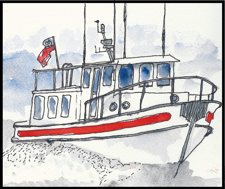
Hanging out in the marina on windy days like yesterday and today have definitely enhanced our social life. Last night we had cocktails with a couple from the 100 year-old converted fishing trawler CAPE BEALE who we met when we were at Sullivan Bay, and tonight we had dinner with a couple we met at Kwatsi Bay. Boats sort of cruise around at their own pace, on their own itinerary, then end up bumping in to one another here and there. You never know who you’ll be anchored next to or moored near.

The weather forecast continues to look promising for Thursday through Sunday, so we’ll probably spend another day here, then start working our way up the Queen Charlotte Strait for an assault on Cape Caution late this week…

Sunday, June 25, 2017

BACKTRACKING TO PORT HARDY

It was a very windy night. I guess that could be expected when you are anchored between a couple of small islands in the middle of Queen Charlotte Strait. Typically, the wind dies down around midnight or so and stays pretty quiet until late morning. That’s not what happened last night - it was windy, with the waves slapping the side of the hull all night.

I got up to check things out around 11:30 and was surprised to still see blue sky on the western horizon. I guess we are pretty far north. We had planned on getting up around 4 AM to get an early start (without wind) around Cape Caution. The weather forecast at 4 AM, however, was not at all promising. Essentially, gale warnings for the next three days. We went back to bed.

Knowing that rounding Cape Caution is now out of the picture for several days, we backtracked a bit and went over to Port Hardy on the north end of Vancouver Island. It wasn’t far, only a couple of hours, and most of it was downwind (more comfortable) although, getting out of the middle of the strait, we saw some pretty lumpy seas for a while.

We did have some company for part of the morning - a pod of dolphins swam along with us, jumping in front of the boat, swimming alongside then darting across the bow. It was fun to watch - they are amazingly agile. Unfortunately, they have sensors which detect when I pick up my camera, and they disappear until I put it down again.

Port Hardy is an OK little town, seems to exist primarily for the fishing crowd. Has the basics - espresso shop, local museum, hardware store, grocery store, etc. We walked through town picking up a few things (Elaine bought yarn at the hardware store). Basically it was a “lay low” day waiting out the wind.

It is not until Thursday that there is a forecasted lessening of the wind. I think we’ve had enough of Port Hardy, so we’re going to try for Port McNeill tomorrow. Even though the wind and seas are going to be a bit uncomfortable, we will be going downwind again, with following seas, so a few hours should be tolerable. We have heard that Port McNeill has a bit more to offer than Port Henry, and I’m sure the marina will be more comfortable and protected.

The current plan is to position ourselves on the north side of Queen Charlotte Strait Thursday, then try again to round Cape Caution on Friday. The forecasts are in our favor, if they are accurate…

Saturday, June 24, 2017

STAGING FOR CAPE CAUTION

Well, I think this will be a quick post. Nothing terribly exciting happened today, and we have minimal cell service, so getting it uploaded may be a challenge.

We discussed whether or not we should head further north. There are a couple of barriers to doing so - one is Cape Caution, an exposed cape at the northern end of Queen Charlotte Strait which has a bad reputation. It is one of the “gateways” to cruising north of the 51st parallel. Rounding the cape, you are fully exposed to the Pacific Ocean (which I always say was badly mis-named), so you must pick the right weather window. Predominate winds are from the northwest this time of year, so if they are blowing, it is at the least uncomfortable going into large waves, at the most, dangerous. The other barrier to going further north is our boat insurance. We are insured only up to the 51st parallel, and if we go further, we must get a rider to our policy with restrictions as to when we can go, and how far we can go north.

We have heard so much about the area north of here, and several people have said we just have to go, so we decided we’re going for it. I emailed my insurance broker and we studied the weather reports and decided to skip Port McNeill for now and stage ourselves for a rounding of Cape Caution. We left Sointula a little late at 12:30, considering the wind usually comes up in the afternoon, and headed up the Queen Charlotte Strait to a protected cove between Staples Island and Kent Island, right in the middle of the strait. We did run into some 3-4 foot seas for a short while, but they calmed down and we anchored in the nice, calm cove about 4:30. We have the very isolated cove all to ourselves.

I got the crab pot out before happy hour and will pick it up later this evening. We want to be ready to go very early in the morning, before the wind comes up. It gets light just after 4 AM, so we should be on our way by then for the 6-7 hour rounding of the cape. We have a couple of bail-out anchorages identified, just in case it gets too rough out there…
Spades Island