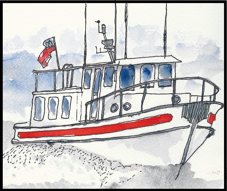
We have actually planned out the next few days. We don’t usually do much planning, other than say “Well, where do you want to go tomorrow?” But, we have specific things we need to get done soon - like get the boat hauled out of the water and have the bottom painted, and retrieve our car from the garage where it is stored in Tacoma.
So, we have made arrangements for the boat to be hauled in Bellingham on Tuesday, August 1st. We will rent a car there, then drive down to Tacoma, return the rental car and pick up our car. We will then drive home to the Bay Area to attack our pile of mail, pull up the plants that have died, make a few appointments, then, in a week or two, fly back up to Bellingham to continue our voyage. The general idea is to bring the boat back down to San Francisco Bay, hopping down the Pacific Coast during periods of good weather and hanging out in harbors of refuge when conditions aren’t just right.
Since we have had a few days to kill before getting to Bellingham, we are just slowly wandering through the San Juan Islands, gradually heading east. Yesterday we anchored in Blind Bay on the eastern side of Shaw Island, dinghied in to shore and took a nice long walk of several miles along the roads. There was minimal traffic, and what little there was came by only just before, or just after the ferry landed on the island.
This morning was a lazy morning. We slept in a bit, then, trying to use up our food stores, cooked breakfast (Spam & eggs burritos) rather than just have the usual cup of coffee. Late morning, we weighed anchor and cruised over to Eagle Harbor on Cypress Island. This is a beautiful little cove where we stayed a night last year when we chartered a boat out of Bellingham. A large portion of Cypress island is owned by the Department of Natural Resources and maintained as a nature
preserve. To prevent damage to the underwater vegetation they have installed mooring buoys so you don’t have to anchor in the cove. We picked up a mooring, then took the dinghy into the beach to go for a hike. Last year we hiked up to the top of Eagle Crest, so we decided to go the other way this time and hike over to a couple of lakes. The trail signage is pretty good, but not perfect, so we put in a little extra milage. We hiked a total of about three and a half hours, over trails that had, obviously, seen little use. It was a nice, warm, sunny day, and we only saw only one other group of hikers. We don’t know exactly how much we climbed, but it was significant - the island tops out at over 1500 feet, and we were very near the top at times.
We will leave here in the morning and head over to Bellingham, spending tomorrow night in the marina in anticipation of having the boat hauled on Tuesday morning. I’ll be taking a short break from the blog while we run home for a week or two, but will resume when we’re back on the boat.
Thanks for reading - hope you have enjoyed it…
Sunday, July 30, 2017
Friday, July 28, 2017
BACK TO THE USA - SHAW ISLAND
It was a short two hour trip from Todd Inlet and Butchart Gardens over to Port Sidney Harbor, however, we had to hang out in front of the marina at Sydney for a while to wait for a slip to open up. This meant that we didn’t actually get tied up until just after noon. This is a big marina, where we have stayed before, and the transient docks (for short-term visitors) are about a five minute walk down a looong dock to the Dockmaster’s Office and land.
Once we were registered, Elaine took off to walk through town, while I spent a couple of hours washing down the boat. This was the first real exterior cleaning I had done since we started in May. With the wind and waves, the boat gets covered in salt, but all the rain we have run into has washed it off. Without seeing any rain for a while, I had to wash it off myself.
We timed it right for the weekly Evening Street Market in downtown Sidney. They close off the main street for three blocks and have both food and craft vendors lining both sides. It is quite a draw, with crowds enough to make walking difficult at times. We opted for an English-style sausage roll for dinner, which we ate at the park down at the waterfront. After an ice cream cone for desert, we walked back to the boat and discovered we could get over 10 channels on our TV. This, after only one channel a couple of nights in Ketchikan for the past couple of months. It was too much for me - I went to bed, but Elaine stayed up late getting her TV fix…
This morning (Friday) we left Port Sidney Harbor and had a nice, short cruise over to Roche Harbor in the San Juan Islands - back in the USA! This means, of course, back through Customs once again. We totally gave up on our Small Vessel Reporting System (SVRS) participation with Homeland Security. I called them yesterday, asked how to go about doing things the right way, since it hasn’t worked the last four times we have tried. They basically said to forget it, it was a program put together by a multi-departmental Task Force and, even though it was a good idea, no one department ever took ownership of it, so it is now almost completely dysfunctional. I could have told them that…
We decided to do the conventional Customs thing, just like everybody else. We pulled in to the Customs Dock, I went up to the office, waited about three minutes, did the interview and the agent came out to the boat for a quick eye-over. It was all done in less time than it takes to get through the SVRS phone menu.
We left Roche Harbor and headed down to Friday Harbor, thinking we would anchor out there for the night and stop by the grocery store in town while there. We tried to find a place to anchor which wasn’t so full of boat traffic and ferry wakes, but never did. We did anchor for a short while to make a run into the store, but then left the utter chaos of a summer Friday at Friday Harbor for a quiet little bay across the channel on Shaw Island…
Wednesday, July 26, 2017
TODD INLET - BUTCHART GARDENS
![]() |
| Sunrise, Nanaimo |
Another early morning to catch the tide. We left Nanaimo at 5:30 so we could get to Dodd Narrows around the slack ebb at 6:39. It was kind of like a parade leaving the anchorage - several boats had the same idea and left around the same time. We got to Dodd Narrows close to 20 minutes early and some boats just hung out, waiting for slack, while others just charged on through. We charged on through and it was pretty underwhelming. We’ve had a lot more current in a lot more places on this trip.
On our trip up, heading north from the Gulf Islands, Dodd Narrows was the first passage where we had to time the tides, and we were quite proud of ourselves for having made it without mishap. Now it’s pretty much old hat. Later in the day, today, we had to go through Sansum Narrows, and we arrived just at the maximum current flow. Oh well, no sense waiting for slack tide. We went on through and, again, no big deal. Sure, there were some whirlpools, some upwellings and an overfall, but they’re all part of the game, now, and we’ve gotten used to handling them.
Since we left Nanaimo so early, we made it to Todd Inlet around noon. This inlet is the “back door” to Butchart Gardens and has a few moorings which can be used by Garden visitors for free. They are in a narrow cove, and you have to tie the stern of your boat to rings set into the rocks for that purpose to keep the boat from swinging into the channel. We have moored here before, but probably at least 25 years ago. I remember, vividly, that it was a place very few people knew about - isolated, quiet, out of the way - but that’s not what it is like now. Once we got to the inlet, I recognized it, but the bay outside of the cove is crowded with moored and anchored boats, there are two marinas there and the shores are covered with condominiums.
Before we got to the inlet, I had thought about the logistics of picking up the mooring ball and setting a stern line to shore. Let’s just say it didn’t quite work out as planned. We did get secured to the mooring ball and we did get a stern line to shore, but in the midst of all of this, the dinghy managed to wander away from the boat. As much as I yelled, and pleaded, for it to come back, it wouldn’t, so there was only one way to recover it. The water wasn’t actually quite as cold as I had anticipated, but it was cold...
The last time we were here, I remember going into the garden through this back door without paying. That is no longer possible, and the prices are pretty incredible - almost $80 for the two of us. It is a beautiful garden, but it has become a “Disneyland” - like tourist attraction with crowds of people, souvenir shops, galleries, ice cream stands, hot dog stands, coffee bars, restaurants and even live stage entertainment and fireworks shows at night. Not quite what I remember. The little cove we are in has routine bay tour boats going in and out, as well as large tour boats bringing passengers from Victoria, and they warn to keep the waterway and dock clear for floatplanes.
I feel like an old curmudgeon, “It didn’t used to be this way…”
Tuesday, July 25, 2017
CAMPBELL RIVER SOUTH TO COMOX THEN NANAIMO
July 24, 25
Fisherman’s Wharf was a very interesting marina in Campbell River. Half of it was mostly pleasure boats and, separated by a pier, the other half was mostly working fishing boats. We were on the fishing boat side and had the opportunity to interact with some very colorful folk. They love to tell stories, one or two of which may have actually been true. They were all entertaining, though.
Since the tidal current is so strong at Campbell River, we waited to leave until the tide turned and we had the current going with us. This meant we didn’t leave the marina until almost noon, then got into Comox after 4 PM. We didn’t really end up getting much help from the current. Along the east side of Vancouver Island, the flood tide comes in from both the north and the south then meets a few miles south of Campbell River. So, the ebb tide north of this point flows north and the ebb tide south of this point flows south. In that middle area, the currents are all mixed up, making for a lumpy, choppy sea.
Other than the sea state, it was a very nice day, the warmest day we have seen up here all summer. By the time we got tied up to the dock, it was over 80 degrees! Luckily, there was a pub right next to the marina (funny how they seem to know that boaters gravitate toward pubs). We sat outside, under the umbrellas, but this time protected from sun, not rain.
Comox is a nice little community with a very nice, inexpensive municipal marina. The community seems to be very water-oriented with the nice weather drawing out the small sailboats, paddleboards, kayaks, fishermen and pleasure boaters into the harbor. There are a couple of other small communities nearby which we did not have time to visit, but the whole area seems quite pleasant.
Again, timing the tides, we left Comox before 7 AM so we could catch the ebb heading south. The first few hours were very smooth and it warmed up nicely with the sun shining. Later, especially when we got out of the lee of a couple of islands, the water started developing some swells, which eventually turned into waves, even though the wind was light. The waves were from the west, and we were heading southeast, so it wasn’t too bad - a lot of movement, but tolerable. While making lunch, I did have to quickly grab the mustard jar as it slid across the countertop, but disaster averted.
Once we ducked into Nanaimo Harbor, however, it was a totally different environment. People were swimming, playing in and on the smooth water - I even saw an outrigger canoe club out paddling. We anchored in a crowded anchorage (it is the “high” season around here for boating), got out the “lounge chairs,” and had some refreshment on the bridge deck in the hot, hot sun. We couldn’t stay up there long before we had to retreat to the shady cabin down below.
Elaine wanted to go to the nearby island to check out the sandstone quarry (where the stones for the San Francisco Mint came from) and the albino raccoons they have there. We tried to find a place to land the dinghy, but couldn't - ending up at a place inaccessible to the quarry. However, what do you know, there was a floating pub with a dinghy dock...
Fisherman’s Wharf was a very interesting marina in Campbell River. Half of it was mostly pleasure boats and, separated by a pier, the other half was mostly working fishing boats. We were on the fishing boat side and had the opportunity to interact with some very colorful folk. They love to tell stories, one or two of which may have actually been true. They were all entertaining, though.
Since the tidal current is so strong at Campbell River, we waited to leave until the tide turned and we had the current going with us. This meant we didn’t leave the marina until almost noon, then got into Comox after 4 PM. We didn’t really end up getting much help from the current. Along the east side of Vancouver Island, the flood tide comes in from both the north and the south then meets a few miles south of Campbell River. So, the ebb tide north of this point flows north and the ebb tide south of this point flows south. In that middle area, the currents are all mixed up, making for a lumpy, choppy sea.
Other than the sea state, it was a very nice day, the warmest day we have seen up here all summer. By the time we got tied up to the dock, it was over 80 degrees! Luckily, there was a pub right next to the marina (funny how they seem to know that boaters gravitate toward pubs). We sat outside, under the umbrellas, but this time protected from sun, not rain.
Comox is a nice little community with a very nice, inexpensive municipal marina. The community seems to be very water-oriented with the nice weather drawing out the small sailboats, paddleboards, kayaks, fishermen and pleasure boaters into the harbor. There are a couple of other small communities nearby which we did not have time to visit, but the whole area seems quite pleasant.
Again, timing the tides, we left Comox before 7 AM so we could catch the ebb heading south. The first few hours were very smooth and it warmed up nicely with the sun shining. Later, especially when we got out of the lee of a couple of islands, the water started developing some swells, which eventually turned into waves, even though the wind was light. The waves were from the west, and we were heading southeast, so it wasn’t too bad - a lot of movement, but tolerable. While making lunch, I did have to quickly grab the mustard jar as it slid across the countertop, but disaster averted.
Once we ducked into Nanaimo Harbor, however, it was a totally different environment. People were swimming, playing in and on the smooth water - I even saw an outrigger canoe club out paddling. We anchored in a crowded anchorage (it is the “high” season around here for boating), got out the “lounge chairs,” and had some refreshment on the bridge deck in the hot, hot sun. We couldn’t stay up there long before we had to retreat to the shady cabin down below.
Elaine wanted to go to the nearby island to check out the sandstone quarry (where the stones for the San Francisco Mint came from) and the albino raccoons they have there. We tried to find a place to land the dinghy, but couldn't - ending up at a place inaccessible to the quarry. However, what do you know, there was a floating pub with a dinghy dock...
Sunday, July 23, 2017
CAMPBELL RIVER, DAY 2
We decided a layover day was in order, first because it was a somewhat stressful day going through Seymour Narrows yesterday, second because we had a lot of laundry to do, third because it was very windy, fourth because we needed to do some boat cleaning, fifth because there was a Farmer’s Market scheduled and sixth because there were a couple of museums we wanted to visit.
![]() |
| Farmer's Market |
Laundry was first - got that done - then the Farmer’s Market, which opened at 10 AM. It was a very nice Market, right at the top of the dock. We bought a few things, brought them back to the boat, then headed up to the Campbell River Museum. That is an excellent little museum, with a varied number and type of exhibits, everything from First Nation history, to local development history, to natural history. We spent a few hours there, including watching a film of the efforts to blow up a large rock in the middle of Seymour Narrows in the 1950s. The rock was such a hazard to navigation, a massive effort was undertaken to get rid of it. The resulting explosion was the largest non-nuclear detonation in history, and it got rid of the rock.
![]() |
| Campbell River Museum |
We then stopped by the Maritime Heritage Museum which, as the name suggests, is focused on the fishing and shipping history of the area. It was not a large museum, but Harold made up for it. Harold is a retired boatman and crabber who constructs incredibly detailed ship models in his spare time and also volunteers as a docent at the Museum. Oh, and Harold loves to talk. Since we were the only two people in the museum, we were the objects of his attention. He actually made the museum much more interesting, although we were relieved when another patron came in and we ran a successful pick and screen.
![]() |
| Maritime Heritage Museum |
One of my objectives for the day was to wash down the boat, but that was thwarted when the fellow from the next boat over started up a conversation. Maybe it’s the long, wet winters around here, or something, but people really like to talk once the sun is shining. We had a very long, wide-ranging conversation (which Elaine managed to duck out of) and the boat is still dirty.
Since he is local, part of the conversation focused on tides and current in the area. Elaine & I watched a few boats trying to swim upstream today, and they made very slow progress. We will be heading south tomorrow, so will need to time our exit from the marina to coincide with the slack ebb tide, or the beginning of flood tide. I actually got a lot of good local knowledge from the guy, so the conversation was probably more valuable than having a clean boat anyway…
Saturday, July 22, 2017
CAMPBELL RIVER
First things first - pictures I couldn’t upload yesterday:
![]() |
| Elaine with her Bear Bell |
![]() |
| Hiking in the Rain |
![]() |
| The Cedar Tree |
Had a nice dinner at the Blind Channel Resort restaurant last evening and a quiet night at their dock. We studied the charts, the tide tables and the current tables to plan out our day today. All of the atypical planning, for us, was because we had to transit Seymour Narrows today. This is a relatively narrow channel between Vancouver Island and Quadra Island. A huge amount of water flows north from the Strait of Georgia through these narrows to Discovery Passage. The currents can run as high as 15 knots, with severe upwellings and whirlpools - severe enough to have sunk ships in the past. You must time your transit to coincide with the slack tide, that is, between the flood tide and the ebb tide - either at the end of the flood or at the end of the ebb. The good news is that we did not have the usual high winds typical of Johnstone Strait, the bad news is that it is a new moon, so the tidal changes are about at their peak flows.
We left Blind Channel around 7 AM and had the current with us the first 4 miles, then we turned on to Johnstone Strait and were bucking a 3-4 knot current. There was a lot of water movement, and it was a challenge keeping the boat headed in the right direction. On top of that, the visibility was very poor, with thick fog intermittently obstructing visibility down to less than a quarter mile. Oh, and it was cold and raining, too. So we had the usual routine of heater, defroster, and windshield wipers, but we added the fog horn to this routine as well. Once we rounded Chatham Point, things calmed down a bit, although we still had a current on the nose.
We timed our arrival at Seymour Narrows to coincide with the slack, but it also coincided with the thickest fog of the day. We had been monitoring the vessel traffic control (kinda like air traffic control, but for commercial ship traffic) on the VHF radio, and knew that a passenger liner and a coast guard cutter were coming through the narrows the opposite way, but we couldn’t see a thing. As they came through, we identified them on radar, but didn’t see them until they had almost passed us.
Even though we went through at slack tide, the water was anything but slack. I increased the engine speed, but at times we were going only 5 knots and then, very quickly, we were going 10 knots. Lots of eddies and whirlpools for a slack tide!
Anyway, we made it through, and the fog lifted. We continued south to Campbell River where we docked at the Fisherman’s Wharf Marina with all of the commercial fishing boats. We took a quick walk into town and perused the art fair along the (closed) main street and ran a couple of errands. There are a couple of museums here in town we’d like to see, and a Farmer’s Market nearby tomorrow morning (and the sun is supposed to shine), so we will decide tonight whether or not to stay here another day...
Friday, July 21, 2017
JONSTONE STRAIT
July 20 & 21 (Can't upload photos - will try later)
I’ll combine a couple of day’s blogs, since not a lot happened yesterday. Yesterday started at Port McNeill just taking care of boat business - filling some tanks, emptying others - and we finally got away around 10 AM. The weather was good, overcast but no rain. We were heading down Johnstone Strait, which has a really bad reputation when the wind and tidal currents are against each other. Luckily, we had a favorable current and little wind most of the day. A pleasant ride, with just a little chop now and then, but, for the most part, smooth.
Our destination was Port Harvey, where we have stayed before at the marina. The marina is being rebuilt, and doesn’t have a lot in the way of amenities, so we just anchored out in the bay this time. I put out some crab pots, since this was where we got the first crab of the trip, but no luck this time. We did have a bunch of crabmeat in the freezer, however, and Elaine made Crab Pasta Pizzicato. This was a dish we both had in Prince Rupert, so she just had to try it. Her explanation: “It’s crab and pasta with an Alfredo sauce, but instead of milk products you use lemon juice and vermouth then add capers.” Somehow I think that ends up being a lot different than an Alfredo sauce, but it was incredibly good, anyway.
This morning we headed further southeast on Johnstone Strait in a steady rain. The tidal currents were both for and against us during the day, but the fastest currents, through Race Passage, were strongly in our favor at about 4-5 knots. That passage was also the area of least visibility, with fog dropping visibility down to less than a quarter mile at times. Definitely radar time. It felt kind of like flying an airplane on instruments only, looking at the GPS to determine location, checking the speed and depth every minute or so and always keeping an eye on the radar to make sure you weren’t headed toward anything (or anything was headed toward you), going 11 or 12 knots. Current that fast causes a lot of swirls, whirlpools and overfalls, all of which affect the handling of the boat, so no autopilot, since you had to react quickly to all of the movement of the water. A nice feature of our instruments is that they can overlay the radar image on top of the electronic chart image, making it easier to identify “targets” that are not land masses.
We got into Blind Channel Resort by early afternoon. We had hoped to stop by here on our way north, but it just didn’t work out. Even though it was pouring down rain, we took advantage of some trails nearby to hike to a 900-year-old cedar tree out in the rain forest. The sign at the beginning of the trail warned of bear, cougar and wolves, but Elaine had her trusty “bear bell” (better known in the Grizzly clans as a “dinner bell”) tied to her shoelace, so we were safe - wet, but safe!
Back at the boat we cleaned up (the trail was kinda muddy) and will be going to dinner at the resort’s restaurant…
I’ll combine a couple of day’s blogs, since not a lot happened yesterday. Yesterday started at Port McNeill just taking care of boat business - filling some tanks, emptying others - and we finally got away around 10 AM. The weather was good, overcast but no rain. We were heading down Johnstone Strait, which has a really bad reputation when the wind and tidal currents are against each other. Luckily, we had a favorable current and little wind most of the day. A pleasant ride, with just a little chop now and then, but, for the most part, smooth.
Our destination was Port Harvey, where we have stayed before at the marina. The marina is being rebuilt, and doesn’t have a lot in the way of amenities, so we just anchored out in the bay this time. I put out some crab pots, since this was where we got the first crab of the trip, but no luck this time. We did have a bunch of crabmeat in the freezer, however, and Elaine made Crab Pasta Pizzicato. This was a dish we both had in Prince Rupert, so she just had to try it. Her explanation: “It’s crab and pasta with an Alfredo sauce, but instead of milk products you use lemon juice and vermouth then add capers.” Somehow I think that ends up being a lot different than an Alfredo sauce, but it was incredibly good, anyway.
This morning we headed further southeast on Johnstone Strait in a steady rain. The tidal currents were both for and against us during the day, but the fastest currents, through Race Passage, were strongly in our favor at about 4-5 knots. That passage was also the area of least visibility, with fog dropping visibility down to less than a quarter mile at times. Definitely radar time. It felt kind of like flying an airplane on instruments only, looking at the GPS to determine location, checking the speed and depth every minute or so and always keeping an eye on the radar to make sure you weren’t headed toward anything (or anything was headed toward you), going 11 or 12 knots. Current that fast causes a lot of swirls, whirlpools and overfalls, all of which affect the handling of the boat, so no autopilot, since you had to react quickly to all of the movement of the water. A nice feature of our instruments is that they can overlay the radar image on top of the electronic chart image, making it easier to identify “targets” that are not land masses.
We got into Blind Channel Resort by early afternoon. We had hoped to stop by here on our way north, but it just didn’t work out. Even though it was pouring down rain, we took advantage of some trails nearby to hike to a 900-year-old cedar tree out in the rain forest. The sign at the beginning of the trail warned of bear, cougar and wolves, but Elaine had her trusty “bear bell” (better known in the Grizzly clans as a “dinner bell”) tied to her shoelace, so we were safe - wet, but safe!
Back at the boat we cleaned up (the trail was kinda muddy) and will be going to dinner at the resort’s restaurant…
Subscribe to:
Posts (Atom)


